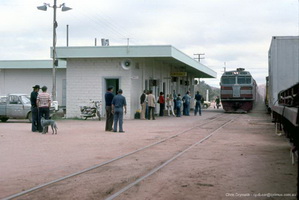
This section contains information about the Alice Springs to Darwin railway section of the standard gauge Central Australian Railway. Line is 1420km in length.
| 2000 | Awarded of contract to build the Darwin - Alice Springs railway to the Asia Pacific Transport Consortium as a Build Own Operate and Transfer back operation. The Australian Government contributed $165 million from the Centenary of Federation Fund, the Northern Territory Government contributed $165 million and the South Australian Government contributed $150 million to the AustralAsia Rail Corporation for the construction of assets by Asia Pacific Transport Consortium and FreightLink that were later leased for a peppercorn rental to FreightLink. In addition, the three Governments contributed about $26 million each, a total of $79 million in further funding to support the Asia Pacific Transport Consortium directly, by way of mezzanine debt financing (subordinated debt), equity and contingent equity.[AustralAsia Railway Corp] |
| 17.7.2001 | Turning of the first sod.[AustralAsia Railway Corp] |
| 17.9.2003 | Darwin reached |
| 2.1.2004 | The section from Alice Springs to Darwin was orginally built by a consortium with the Infrastructure being owned by "Freight Link Pty Ltd". Operational Access Manager was "Australian Southern Railroad". The line was constructed to provide normal operations for trains that do not exceed 1800 metres. [ASR Network Operating Guide Pt 32] |
| 17.1.2004 | First freight train reached Darwin having departed on 15.1.2004 [AustralAsia Railway Corp] |
| 3.2.2004 | Arrival of first passenger train in Darwin having departed 1.2.2004 [AustralAsia Railway Corp] |
| 19.5.2008 | Freightlink board, shareholders and lenders agreed to sell its ownership of the Adelaide to Darwin rail link after failing to make a profit since the railway line commenced operation.[Financial Review 19.5.2008] |
| 6.11.2008 | Freightlink goes into voluntary administration after failing to reach agreement with creditors on the terms of a sale of the business.[ Northern Territory News. 7.11.2008] |
| 11.1934 | Alice Springs 771m narrow gauge [SAR PTT 11.1934] |
| 6.1953 | Alice Springs 771m narrow gauge [SAR PTT 6.1953] |
| 2.1973 | Alice Springs 771m narrow gauge [PTT 2.1973] |
| - | Alice Springs narrow gauge - 771 miles 11 chains |
| 2.1.2004 | Alice Springs - Defined as Block Location - Terminal with nil loop - South Yard Location Board 1334.000km, Center 1335.00km, North Yard Location Board 1338.60Km [ASR Network Operating Guide Pt32] |
| 2.1.2004 | 1400 BP - Defined as Block Point Location - nil loop - Center 1400.00km [ASR Network Operating Guide Pt 32] |
| 2.1.2004 | 1449 BP - Defined as Block Point Location - nil loop - Center 1449.00km [ASR Network Operating Guide Pt 32] |
| 2.1.2004 | 1503 BP - Defined as Block Point Location - nil loop - Center 1503.00km [ASR Network Operating Guide Pt 32] |
| 2.1.2004 | Illoquara - Defined as Block Point Location - Crossing Loop 1850 m length - South Yard Location Board 1561.25km, Center 1564.250km, North Yard Location Board 1567.20Km [ASR Network Operating Guide Pt 32] |
| 2.1.2004 | 1622 BP - Defined as Block Point Location - nil loop - Center 1622.00km [ASR Network Operating Guide Pt 32] |
| 2.1.2004 | 1664 BP - Defined as Block Point Location - nil loop - Center 1664.00km [ASR Network Operating Guide Pt 32] |
| 2.1.2004 | 1735 BP - Defined as Block Point Location - nil loop - Center 1735.00km [ASR Network Operating Guide Pt 32] |
| 2.1.2004 | Tennant CreekDefined as Block Point Location - Crossing Loop 1850 m length - South Yard Location Board 1799.60km, Center 1802.50km, North Yard Location Board 1805.60Km [ASR Network Operating Guide Pt 32] |
| 2.1.2004 | 1900 - Defined as Block Point Location - nil loop - Center 1900.00km [ASR Network Operating Guide Pt 32] |
| 2.1.2004 | 2004 - Defined as Block Point Location - nil loop - Center 2004.00km [ASR Network Operating Guide Pt 32] |
| 2.1.2004 | Newcastle Waters - Defined as Block Point Location - Crossing Loop 1850 m length - South Yard Location Board 2091.53km, Center 2093.00km, North Yard Location Board 2095.50Km [ASR Network Operating Guide Pt 32] |
| 2.1.2004 | 2222 BP - Defined as Block Point Location - nil loop - Center 2222.00km [ASR Network Operating Guide Pt 32] |
| 2.1.2004 | 2343 BP - Defined as Block Point Location - nil loop - Center 2343.00km [ASR Network Operating Guide Pt 32] |
| 2.1.2004 | Defined as Block Point Location - Crossing Loop 1850 m length - South Yard Location Board 2441.90km, Center 2446.50km, North Yard Location Board 2451.10Km [ASR Network Operating Guide Pt 32] |
| 2.1.2004 | 2553 BP - Defined as Block Point Location - nil loop - Center 2553.00km [ASR Network Operating Guide Pt 32] |
| 2.1.2004 | 2662 BP - Defined as Block Point Location - nil loop - Center 2662.00km [ASR Network Operating Guide Pt 32] |
| 2.1.2004 | Berrimah - Defined as Block Point Location - terminal with 1850 m loop - South Yard Location Board 2747.000km, Center 2750.00km [ASR Network Operating Guide Pt 32] |
